WWF & Eyes on the Forest
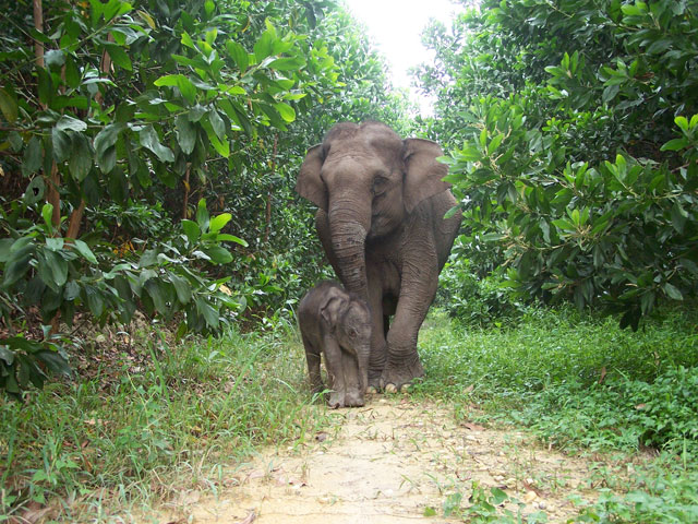
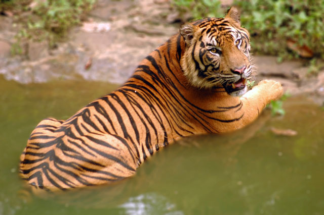
In 2011, camera traps set by WWF and the Indonesian Ministry of Forestry captured footage of an impressive 12 tigers, including tiger cubs frolicking in the central Sumatran landscape of Bukit Tigapuluh, also known as Thirty Hills. Excited by the presence of these tigers and concerned because they were living in a forest slated for deforestation, WWF created a Google Earth narrated tour telling the story of the deforestation in Bukit Tigapuluh. Eyes on the Forest (EoF), a coalition of Sumatran NGOs, then decided to distribute information about deforestation and disappearing habitats on the island to a broader audience using mapping site based on the Google Cloud.
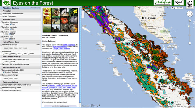
Spurred on with a Google Earth Outreach Developer Grant, WWF hired developer David Tryse to build eyesontheforest.or.id, a catalog of maps rich with information about the change in Sumatra’s forest cover, tiger, elephant, rhino and orangutan ranges, floral diversity and carbon stocks over time.
How they did it
The many heavy data layers on the map are displayed using pre-rendered image tiles stored on Google Cloud Storage, with the image tiles rendered in GeoServer and Google Earth Engine. To make layers interactive on the site UTFgrid JSON tiles were used to provide click and hover functionality. Smaller data layers are served via GeoJSON.
Impact
WWF and EoF are excited to release these maps within a storytelling platform to brief viewers about the magnificent conservation values of Sumatra. They also hope to educate viewers about the history and impacts of deforestation on Sumatra. Since 2012, they have continued to publish more and more data to demonstrate how global commodities are changing the landscape, often in violation of existing rules and regulations. Members of the public – such as commercial buyers of palm oil and paper products from Sumatra – are able to ground truth corporate claims of sustainable production without leaving home by creating their own maps with suppliers’ land holdings related to loss of forest, carbon stocks and biodiversity.
In 2015, EoF published reports and new data on the map to demonstrate the pulp & paper industry’s involvement in serious peat fires in South Sumatra that caused serious haze in Singapore. The work was mentioned by The Straits Times, Singapore Institute on International Affairs and others. In 2016, EoF published a report and new data which shows that the global palm oil supply chains are still tainted with illegal products deriving from deforestation in government protected areas in the last remaining habitat of critically endangered Sumatran elephants, tigers and orangutans. Several of the world’s biggest producers and traders of palm oil are involved, and the industry has still not found a way to identify the origin of palm oil fruit they buy. All the companies highlighted by the report responded to the report positively and the story was picked up by media as well as the Singaporean Ministry of Environment and Water Resources.